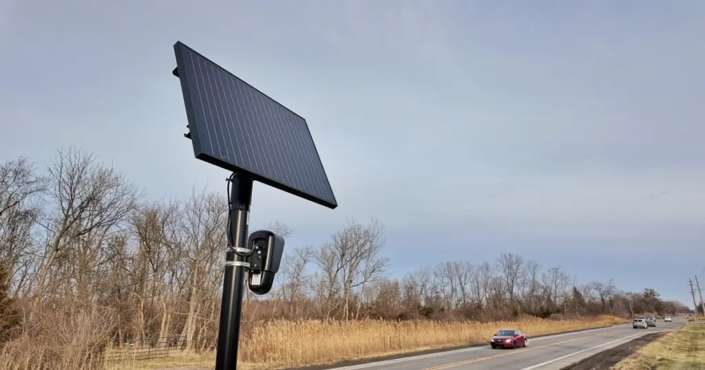
- MapQuest has rolled out an update featuring a dedicated Surveillance Layer that reveals known outdoor surveillance hardware.
- The feature highlights automated license plate readers (ALPR) from Flock Safety, Motorola, Axis, and other major vendors alongside their viewing directions.
- Users can toggle the tool via Map Options adjacent to standard traffic and incident reporting layers.
Visualizing Roadside Monitoring Systems
Pioneering navigation platform MapQuest has released an application update that integrates an unexpected feature for privacy-conscious commuters: a dedicated Surveillance Layer. Integrated directly into the platform’s Map Options menu alongside incident feeds and real-time traffic statistics, the tool maps out known outdoor tracking hardware across neighborhoods and transit corridors.
When enabled, the map populates with eyeball icons marking the coordinates of automatic license plate recognition (ALPR) installations. Crucially, the interface also illustrates the direction each lens faces, offering drivers visibility into the coverage orientation of roadside optical sensors.
Vendor Coverage and System Details
The service maps hardware beyond standard traffic cameras, documenting network-connected equipment from an extensive roster of private contractors and surveillance suppliers commonly deployed by law enforcement agencies and neighborhood associations.
| Feature Component | MapQuest Implementation Detail |
|---|---|
| Interface Access | Map Options menu (alongside Traffic and Incidents) |
| Map Indicator | Eyeball icon showing lens field direction |
| Tracked Vendors | Flock Safety, Motorola Solutions (Vigilant), Genetec, Axis Communications, Axon, Leonardo (ELSAG), Neology, Rekor, PlateSmart, Ubicquia, Verkada |
| Primary Utility | Identification of ALPR scanner networks and line of sight |
Privacy Implications and Pushback
The feature debut follows an increase in MapQuest application downloads recorded in September. The deployment highlights the ongoing friction surrounding public surveillance infrastructure. While municipal authorities and police departments state that ALPR systems enhance public safety and streamline criminal investigations, critics emphasize surveillance overreach, warrantless vehicle tracking across state jurisdictions, and database errors that have historically led to the wrongful detention of drivers.
While this layer enables drivers to navigate around known monitoring points, MapQuest’s implementation also makes it apparent that densely instrumented regions leave drivers with few detour alternatives to avoid automated vehicle detection.
Everyday motorists now possess a built-in method to identify automated plate-reading networks in their local area. By bringing vendor-agnostic camera locations directly into everyday navigation, the tool shifts surveillance awareness into standard consumer software.



Showing the lens direction is a fascinating detail that sets this apart from typical traffic alerts. How frequently is this database updated as new hardware gets installed, and does anyone know if they rely on public records or crowdsourced reports for camera verification?